


Voting District 45, Gaston County, North Carolina
About
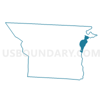
Outline

Summary
| Unique Area Identifier | 640133 |
| Name | Voting District 45 |
| County | Gaston County |
| State | North Carolina |
| Area (square miles) | 6.70 |
| Land Area (square miles) | 6.02 |
| Water Area (square miles) | 0.68 |
| % of Land Area | 89.82 |
| % of Water Area | 10.18 |
| Latitude of the Internal Point | 35.32319260 |
| Longtitude of the Internal Point | -81.00226740 |
Maps


Graphs
Select a template below for downloading or customizing gragh for Voting District 45, Gaston County, North Carolina


Neighbors
Neighoring Voting District (by Name) Neighboring Voting District on the Map
- Voting District 223.1, Mecklenburg County, NC
- Voting District 224, Mecklenburg County, NC
- Voting District 26, Gaston County, NC
- Voting District 42, Gaston County, NC
- Voting District 43, Gaston County, NC
- Voting District 46, Gaston County, NC
Top 10 Neighboring County Subdivision (by Population) Neighboring County Subdivision on the Map
- Township 1, Charlotte, Mecklenburg County, NC (731,424)
- South Point township, Gaston County, NC (40,484)
- Riverbend township, Gaston County, NC (26,596)
- Township 12, Paw Creek, Mecklenburg County, NC (6,563)
Top 10 Neighboring Place (by Population) Neighboring Place on the Map
Top 10 Neighboring Unified School District (by Population) Neighboring Unified School District on the Map
Top 10 Neighboring State Legislative District Lower Chamber (by Population) Neighboring State Legislative District Lower Chamber on the Map
- State House District 98, NC (125,672)
- State House District 101, NC (94,041)
- State House District 108, NC (79,640)
Top 10 Neighboring State Legislative District Upper Chamber (by Population) Neighboring State Legislative District Upper Chamber on the Map
- State Senate District 38, NC (238,282)
- State Senate District 41, NC (207,713)
- State Senate District 43, NC (173,686)
Top 10 Neighboring 111th Congressional District (by Population) Neighboring 111th Congressional District on the Map
Top 10 Neighboring Census Tract (by Population) Neighboring Census Tract on the Map
- Census Tract 60.07, Mecklenburg County, NC (6,643)
- Census Tract 60.08, Mecklenburg County, NC (3,635)
- Census Tract 301.01, Gaston County, NC (3,383)
- Census Tract 301.02, Gaston County, NC (3,315)
- Census Tract 312.01, Gaston County, NC (3,080)
- Census Tract 302.04, Gaston County, NC (3,000)
- Census Tract 60.05, Mecklenburg County, NC (2,854)
- Census Tract 311.01, Gaston County, NC (2,767)
- Census Tract 311.02, Gaston County, NC (2,201)